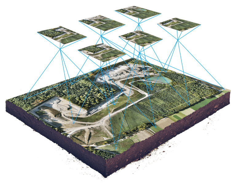
Using drone solutions for mapping we create “photo maps” from overhead photographs and removing distortion and enabling accurate measurements through GSD (Ground sampling distances) allow human operators to generate and compile Othomosaic, precise digital elevation models, contours, volume measurements, and more.
Aeromat can reach even the most inaccessible, hazardous or large-scale sites using the latest drone technology to provide a range of survey and mapping services. Our highly-experienced team can safely capture high-resolution imagery and survey-grade data faster than traditional methods.
We have full time project managers, full time internal pilots and we have a nationwide network of licensed, insured drone pilots who can tackle any size project. We have years of experience working with surveyors and mappers to assist with their projects.

Effective way to inspect and manage cell towers with improved speed, efficiency, safety.