DRONE SURVEY & MAPPING
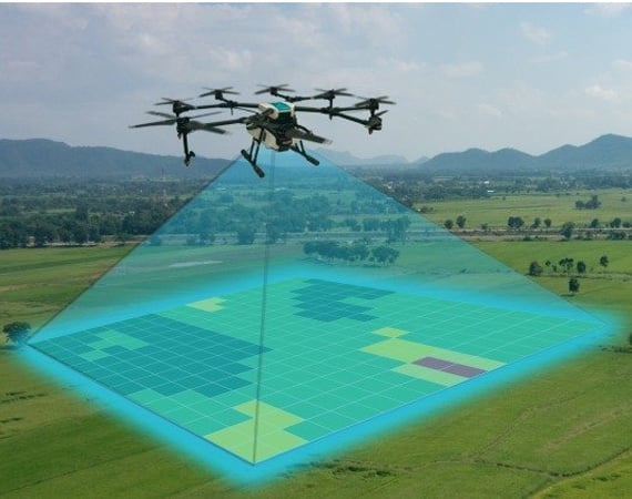
There is a constant revolutionary change in every few years and, hence the geospatial industry undergoes transpose. First, it was total stations, and lately GPS, laser scanners, and robotics. Now, crackerjack wizards are adding innovative tools, surveying drones, which impose quick data collection, excellent positional accuracy, and a safe operator experience.
We have even reached the most unapproachable, speculative & Extensive sites using the latest drone technology to provide a range of survey and mapping services. Our highly-experienced team can safely capture high-resolution images and survey-grade data faster than old-fashioned methods.
We started in 2018 and have been in full swing since, we have full-time project GIS experts, full-time internal certified pilots, insured drone pilots who can tackle any size project.
Aeromat Creative Labs Pvt. Ltd we strive to provide drone mapping services. the aerial solutions for various public and private sectors in Land Surveying, Aerial Surveying for Land Management & Development, Land Slope monitoring, Volumetric Surveys, Smart cities Planning, Mapping greenfield projects, etc. our experience remains incomparable. We focus on providing expertise services, thus, perpetually continuing to achieve highly accurate topographic maps with Centimeter level Accuracy at any given time. Decked with End to End Surveying (RGB) drones and a crew of skilled RPAS pilots, our clients obtain the deliverables faster, we see to it end to end client expectations are met.
Deliverables we provide:
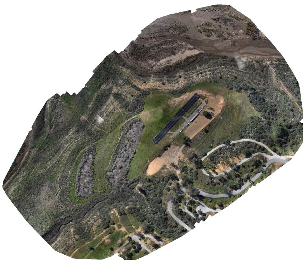
- Orthomosaic Maps
- 3D Mapping
- 3D Point Cloud
- Digital Surface Models (DSM)
- Digital Elevation Model (DEM)
- Digital Terrain Model (DTM)
- Construction Progress
- Site Visualisations
- Contour Maps
- 3D Textured Maps